

Introduction
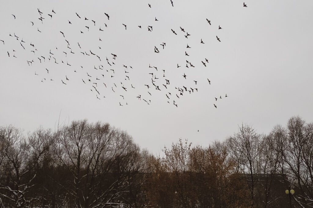
Winter is sometimes described as a quiet period for ecological survey work. In reality, it is a vital field season for ornithologists and for project teams whose developments may affect migratory birds, waterbirds, waders, wildfowl, or other species that use Ireland during the non-breeding season.
The island of Ireland lies on major migratory routes and offers a comparatively mild winter climate, extensive estuaries, sheltered bays, lakes, rivers, wetlands, callows, farmland and grassland. These habitats can provide feeding, resting and roosting opportunities for birds that arrive from northern Europe, Iceland, Greenland, Arctic Canada and other regions. Some locations support nationally or internationally important numbers. Other sites may hold smaller populations but still play a valuable role within a wider network of habitats.
For developers, engineers, architects, planners, public bodies and landowners, the central question is not simply whether birds have been seen on a site. It is whether the proposed project could affect important bird populations, the habitats on which they depend, their movement between feeding and roosting areas, or the conservation objectives of a protected site.
A well-designed winter bird survey helps answer that question. It creates an evidence base that can guide design, inform impact assessment, identify appropriate mitigation and reduce avoidable uncertainty during planning or consenting. However, that evidence must be gathered while the relevant birds are present. If the required winter window is missed, it may not be possible to replace the missing information until the following season.
This article explains what winter bird surveys are, when they may be needed, how they are designed, how they support the planning process, and why early engagement with an experienced ecological consultant is so important.
What is a winter bird survey?
A winter bird survey is a structured programme of fieldwork used to understand how birds use a defined area during the non-breeding season. Depending on the project, the study may focus on waterbirds, waders, geese, swans, raptors, farmland birds, or a broader winter bird assemblage.
The survey is designed to collect more than a species list. It may record abundance, distribution, behaviour, habitat use, flight direction and height, arrival and departure patterns, feeding and resting areas, roosts, and responses to existing disturbance. The ecological consultant can then interpret these observations in the context of the proposed development and the wider landscape.
Commercial surveys differ from national monitoring programmes. National schemes such as the Irish Wetland Bird Survey (I-WeBS) and the Wetland Bird Survey (WeBS) provide valuable information about waterbird populations and long-term trends. Project-specific surveys address a different question. They are designed around a particular site, project footprint, zone of influence, and potential impact pathway.
Existing monitoring data can strengthen a desk study and help identify important species or sites, but it may not show precisely how birds use the land affected by a proposed development. Conversely, new field surveys should not be planned without reviewing the available contextual data. A robust assessment normally combines an appropriate desk study with proportionate, project-specific fieldwork.
Why Ireland matters for wintering birds
Ireland’s geographical position and maritime climate make it an important winter destination for migratory birds. Estuaries and intertidal habitats can support large concentrations of waders and wildfowl. Inland wetlands, lakes and callows may provide feeding and roosting habitat. Improved and semi-improved grasslands can be used by geese, swans, plovers and other species. Coastal fields, river valleys and agricultural landscapes may form part of regular daily movement routes.
This landscape-scale use is important in development planning. Birds do not recognise the red line boundary of a planning application. They may roost within a protected wetland, feed on agricultural land several kilometres away, and travel between the two at predictable times. A field outside the boundary of a Special Protection Area may therefore have an ecological relationship with birds associated with that SPA. Whether that relationship is significant must be established by evidence rather than assumed.
Winter bird interest is also not limited to obvious coastal wetlands. Floodplains, reservoirs, quarry lakes, pasture, tillage, amenity grassland, industrial land near estuaries and even temporarily wet fields can attract birds. This is why an initial ecological review should consider habitat, location, hydrological connections, protected sites, existing records and the nature of the proposed development.
When are winter bird surveys carried out?
For planning purposes, September to March provides a useful broad indication of the winter non-breeding survey season. I-WeBS records waterbirds during this period, and September to March is also the core counting season used by WeBS in Northern Ireland and Great Britain.
That broad period should not be treated as a universal rule for commercial survey design. The appropriate months depend on the species and the questions under consideration. Some species arrive early or leave late. Passage movements can occur at the beginning and end of winter. Numbers at a site may vary with weather, water levels, agricultural activity, disturbance, food availability and tide state.
Survey frequency is equally project-specific. A monthly visit might be suitable for one study, while another may need fortnightly visits, coordinated tidal counts, dawn or dusk roost work, or a defined number of vantage-point hours. Wind energy and overhead line projects may require detailed flight-activity data. Coastal developments may need surveys across different stages of the tidal cycle. A proposal near a goose or swan feeding area may require work that captures movements between roosts and feeding fields.
The need for one or more survey seasons must also be considered. One winter may sometimes provide a suitable baseline. In other circumstances, the scale or risk profile of the project, variation between years, the sensitivity of the site or consultation requirements may justify additional seasons. This decision should be made during scoping, not after the first season has ended.
The safest commercial message is straightforward: discuss potential winter bird requirements as early as possible, ideally while the project programme and design still have flexibility.
Which projects may require winter bird surveys?
There is no automatic rule that every development requires a full winter bird survey. Requirements should be proportionate to the likelihood and potential significance of effects. However, surveys are commonly considered for projects that could affect suitable habitat, protected sites, important bird populations or regular flight routes.
Relevant development types can include:
- onshore wind farms and single turbines
- solar farms and battery or substation infrastructure
- overhead electricity lines and grid connections
- housing and mixed-use developments
- roads, bridges, railways and other transport infrastructure
- ports, harbours, coastal works and marine infrastructure
- industrial and commercial development
- quarries, extraction sites and large earthworks
- flood-relief and drainage schemes
- wastewater, water-supply and pipeline projects
- forestry, peatland and land-use change proposals
- habitat restoration or management projects requiring a baseline
The type of potential effect is as important as the type of project. A development may remove feeding habitat, disturb a roost, alter drainage, introduce lighting, create a collision risk, form a barrier to movement, or cause birds to avoid an area. Construction traffic, personnel, noise and visual disturbance can also be relevant, particularly where birds depend on limited high-tide roosting or feeding locations.
The legal and planning context in the Republic of Ireland
Wild birds are protected by national and European law. The Wildlife Act 1976, as amended, provides protection for wild birds, nests and eggs, subject to the detailed provisions and lawful exceptions in the legislation. The European Communities (Birds and Natural Habitats) Regulations 2011, as amended, are an important part of the framework for implementing the EU nature directives in Ireland. Those Regulations were amended again in 2026.
The EU Birds Directive is central to the conservation of wild birds and their habitats. Special Protection Areas are designated for important bird species and migratory populations. Together with Special Areas of Conservation, these SPAs form part of Ireland’s Natura 2000 network of European sites.
Where a plan or project could have a likely significant effect on a European site, alone or in combination with other plans or projects, Appropriate Assessment requirements may apply. Winter bird data can be important where the proposal could affect an SPA, birds that are Special Conservation Interests of an SPA, wetland habitat supporting those birds, or land outside a designated boundary that is functionally used by the relevant population.
Survey results may also contribute to an Ecological Impact Assessment or, for projects that require Environmental Impact Assessment, the biodiversity chapter of an Environmental Impact Assessment Report. These processes serve different legal purposes but may draw on the same carefully collected baseline information.
It is important not to overstate the legal conclusion at the survey stage. Recording a protected or notable bird does not automatically make a development unacceptable. Equally, the absence of birds on one visit does not demonstrate that a site has no winter bird value. The role of the consultant is to gather sufficient evidence, evaluate the population and habitat context, identify credible impact pathways, and support a legally and ecologically robust assessment.
The legal and planning context in Northern Ireland
In Northern Ireland, wild birds are protected under the Wildlife (Northern Ireland) Order 1985, as amended. The Conservation (Natural Habitats, etc.) Regulations (Northern Ireland) 1995, as amended, provide the framework for the protection and assessment of Special Protection Areas and Special Areas of Conservation within the UK national site network.
If a development has the potential to affect an SPA, SAC or Ramsar site, the competent authority may require a Habitats Regulations Assessment. DAERA advises that planning applications should include the appropriate survey information and notes that applications can be delayed if additional surveys are requested.
Terminology differs between the two jurisdictions. In the Republic of Ireland, the process is generally referred to as Appropriate Assessment. In Northern Ireland, Habitats Regulations Assessment is the usual term. In each case, the practical requirement is similar: the decision-maker needs reliable, relevant evidence to assess potential effects on protected sites and their conservation features.
Veon’s cross-border capability helps clients whose projects or portfolios extend across both jurisdictions. Survey design and reporting can be coordinated while respecting the distinct legislation, planning systems, protected-site terminology and consultation expectations applicable in each location.
What does a winter bird survey record?
A good survey programme is designed around defined objectives. Depending on those objectives, field records may include:
- species and numbers of individuals
- age or sex classes, where relevant and reliably identifiable
- precise location and distribution
- feeding, loafing, resting or roosting behaviour
- direction and height of flight activity
- use of fields, wetlands, waterbodies, shorelines or intertidal zones
- movement between roosting and feeding areas
- timing of arrival, departure or peak activity
- responses to people, vehicles, dogs, machinery or other disturbance
- weather, visibility, water level and tide conditions
- habitat condition and changes in land management
The spatial record is particularly important. A total count for a large site may obscure patterns that matter to design. Birds might be concentrated in one field, along one shoreline, at a specific high-tide roost or within a regular flight corridor. Mapping these patterns can help a design team avoid the most sensitive areas or consider buffers, layout changes and construction controls.
Common survey methods
No single method covers every winter bird question. A survey programme may combine several approaches.
Desk study and initial scoping
The consultant reviews protected sites, conservation objectives, mapped habitats, existing bird records, national monitoring information, previous reports, aerial imagery and the proposed development. This work helps identify likely target species, potential connections with SPAs or Ramsar sites, and gaps requiring field investigation.
The desk study should inform fieldwork, not automatically replace it. Data age, spatial resolution, coverage and licensing restrictions must be considered. Recent, high-quality data may reduce uncertainty, but only if they are relevant to the specific site and proposal.
Winter bird walkover or distribution survey
An experienced surveyor follows a planned route or covers defined survey sectors, recording birds and their behaviour. The method may be suitable for farmland, grassland, wetlands, reservoirs, industrial land, or mixed habitats. Repeat visits help to understand seasonal changes and reduce the risk of relying on an unrepresentative day.
Wetland and waterbird counts
Counts may focus on lakes, estuaries, rivers, reservoirs, lagoons or coastal habitats. Surveyors record species, abundance, distribution and activity while minimising disturbance. Where a site is tidal, visit timing may need to reflect different tidal states or coincide with periods when birds gather at high-tide roosts.
Low-tide and intertidal distribution surveys
At estuaries and coastal sites, the distribution of feeding birds can shift as mudflats and sandflats are exposed or covered. Low-tide surveys can show which parts of the intertidal area are used most intensively. This information can be important for coastal infrastructure, recreation proposals, ports, flood defences and projects affecting access or disturbance patterns.
Roost surveys
Roosts can be highly sensitive because many birds may depend on a limited number of safe locations when feeding habitat is unavailable or at night. Surveys may be timed around high tide, dawn or dusk, depending on the species and location. The work should be carefully planned so that the survey itself does not disturb the birds.
Vantage-point and flight-activity surveys
From defined observation points, surveyors record flights through a study area, noting species, numbers, direction, duration and estimated height. This method is commonly used for wind energy assessment and may also be relevant to overhead lines or other structures where collision or barrier effects need to be considered.
The duration, number and location of vantage points must be sufficient to cover the relevant airspace and address the questions. Poorly placed points, obstructed views or insufficient survey effort can create significant uncertainty.
Goose and swan feeding-distribution surveys
Geese and swans may travel considerable distances between roosts and feeding areas. Surveys can be used to identify regularly used fields, flock sizes, movement routes and changes in distribution. Agricultural management, crop type, flooding and disturbance can all influence where the birds occur.
Targeted species surveys
Where a desk study or initial fieldwork identifies a specific conservation concern, a tailored survey may be required. The method should reflect the species’ ecology, the impact pathway and any relevant guidance or consultation advice.
How survey design is agreed
Survey design should begin with a clear conceptual model of the project. What will be built? Which habitats could be lost or altered? What are the construction and operational activities? How far could noise, movement, lighting, drainage changes or collision risk extend? Which bird populations could be affected?
The ecologist then defines the study area, target species, survey methods, visit schedule and reporting outputs. Proportionality is important. A small, low-risk project remote from suitable habitat should not automatically receive the same survey programme as a wind farm close to an SPA. At the same time, reducing survey effort simply to meet a short programme can be a false economy if the resulting evidence is inadequate for assessment.
Early consultation with the planning authority or relevant nature conservation body may be valuable for sensitive or complex proposals. It can help the project team understand expectations before committing to a programme. Consultation does not transfer responsibility for professional survey design, and responses should be considered alongside legislation, published guidance, professional judgement and the specifics of the proposal.
Potential effects that winter bird data can help assess
Habitat loss
A project may remove or reduce access to feeding, resting or roosting habitat. The ecological significance depends on the extent and quality of habitat affected, its use by birds, the availability of alternatives and the importance of the population.
Disturbance and displacement
Birds may respond to people, vehicles, construction plant, noise, lighting, dogs, recreational activity, or the presence of new structures. Repeated disturbance can reduce feeding time or cause birds to avoid otherwise suitable habitat. Displacement is not necessarily confined to the project footprint, so the likely zone of influence must be considered.
Collision risk
Wind turbines, overhead lines, meteorological masts, buildings and other structures can pose collision risks for certain species. The extent of the risk depends on flight behaviour, location, design, visibility and other factors. Project-specific flight data may be required to assess the risk accurately.
Barrier effects
Structures or arrays may alter regular movement routes between feeding and roosting sites. Even when birds avoid collisions, repeated diversions can increase energy expenditure or change habitat use.
Hydrological and habitat change
Drainage, flood defence, water abstraction, discharges, earthworks, or changes in land management can alter water levels, sediment, vegetation, or food resources. These indirect effects can be as important as direct land take.
Cumulative and in-combination effects
A project may be modest in isolation but still contribute to a wider pattern of habitat loss, disturbance or collision risk. Appropriate Assessment and environmental impact assessment processes may require consideration of other plans and projects. Reliable baseline data help ensure that analysis is evidence-led.
How winter bird findings can influence design
The greatest value is created when ecological information reaches the design team early enough to inform decisions. Possible design responses may include:
- retaining important feeding or roosting areas
- relocating infrastructure away from regular flight corridors
- adjusting turbine, overhead-line or access-road layouts
- maintaining buffers from sensitive shorelines or wetlands
- protecting visual screening to reduce disturbance
- controlling lighting and avoiding unnecessary illumination
- scheduling disruptive work outside sensitive periods
- managing construction access, noise and personnel movements
- creating or improving alternative habitat where appropriate
- establishing monitoring and adaptive management measures
These are examples, not standard prescriptions. Mitigation must address the effects identified for the individual project. A generic buffer or seasonal restriction should not be presented as adequate without an ecological rationale.
Avoidance is generally more reliable than mitigating a problem after the design has been fixed. Early survey information can therefore support both ecological protection and commercial efficiency. It can reduce redesign, clarify land requirements, and give the planning team a better understanding of constraints before key decisions are locked in.
Winter bird surveys and Appropriate Assessment
An Appropriate Assessment or Habitats Regulations Assessment is not merely a list of designated sites near a project. It considers credible pathways through which the proposal could affect a protected site’s conservation objectives or integrity.
Winter bird surveys may be important where birds associated with an SPA use land or water within the project’s zone of influence. This can include habitat outside the designated boundary. For example, birds may feed in fields beyond an SPA and return to the protected wetland to roost. The importance of that off-site habitat depends on evidence such as frequency of use, numbers, seasonality, available alternatives and the relationship with the SPA population.
The survey report should set out clear methods, results, maps, limitations and interpretation. The appropriate assessment document can then draw on those findings. The ecological survey and the legal assessment are linked but are not the same document and should not be confused.
Winter bird surveys and Ecological Impact Assessment
An Ecological Impact Assessment evaluates effects on ecological features at appropriate geographic scales. Winter bird data can help identify which species or assemblages are important, predict how they may respond to the project, and determine whether effects are significant.
The assessment should distinguish between recorded facts, professional interpretation and assumptions. It should explain the confidence in the baseline, acknowledge limitations and describe how mitigation alters the predicted effects. Where monitoring is proposed, the objectives, triggers and possible corrective actions should be clearly defined.
For projects requiring an Environmental Impact Assessment Report, this information may form part of the biodiversity chapter and associated technical appendices. Good coordination is needed to ensure that survey conclusions are consistently reflected in the design, construction methodology, mitigation schedule and other chapters.
Why early booking matters
Ecological survey seasons create programme constraints that cannot always be resolved by adding resources. Several competent surveyors may increase capacity, but they cannot recreate the distribution of a migratory population once it has left the country.
Late commissioning can cause several problems:
- the survey programme may start after important early-winter or passage activity
- there may be insufficient visits to characterise seasonal variation
- tidal or weather conditions may reduce the number of suitable survey opportunities
- consultation may identify additional work when little time remains
- design decisions may be made without adequate bird information
- the planning application may contain an evidence gap
- another winter season may be required before the assessment can be completed
Early booking gives the consultant time to review the project, complete the desk study, inspect the site, agree access, identify safe observation points, prepare maps, and begin fieldwork at the appropriate time. It also helps to coordinate winter bird surveys with habitat surveys, hydrology, noise, landscape, engineering, and other workstreams.
The cost of a missed season
The direct cost of a survey is usually only part of the commercial picture. If missing data delay a planning application, land option, grid connection, procurement decision or construction programme, the wider cost can be much greater.
This does not mean every project should commission extensive surveys as a precaution. The better approach is early, proportionate scoping. A competent ecologist may conclude that a full winter programme is unnecessary, recommend a limited, targeted survey, or advise that existing data are adequate for a specific question. The value lies in making that decision early and documenting the reasoning.
Survey quality and professional competence
Bird identification is a core skill, but a commercial winter bird survey requires more than recognising species. The surveyor must estimate flock sizes, interpret behaviour, work safely in challenging winter conditions, apply the chosen method consistently, record spatial information accurately, and understand the assessment question.
The consultant responsible for the programme must also design proportionate fieldwork, manage data, identify limitations, understand the conservation objectives of protected sites, evaluate potential impacts, and communicate with a multidisciplinary project team.
Quality assurance should cover field records, species names, counts, coordinates, mapping, weather and tide information, survey effort, and report consistency. Where large datasets or flight records are involved, a clear data structure and audit trail are essential.
Practical considerations before fieldwork
Access arrangements should be confirmed early. Winter ground conditions, livestock, forestry operations, shooting activity, tidal hazards, deep water, public access and road safety may all influence the survey plan. Observation points must be safe and offer suitable visibility without disturbing birds or unnecessarily entering sensitive habitat.
Landowners and site managers should understand that surveyors may need access at dawn, dusk, weekends or during specific tide states. Changes in land management should be recorded, as ploughing, grazing, crop harvesting, slurry spreading, flooding or temporary disturbance can alter bird distribution.
Surveyors should also have contingency plans for unsuitable weather. Heavy rain, fog, strong winds or poor visibility can reduce detection or make flight-height estimates unreliable. A commercial programme should allow sufficient flexibility to reschedule visits without compromising coverage.
What a winter bird survey report should contain
A clear report normally describes:
- the project and purpose of the survey
- the study area and relevant zone of influence
- desk-study sources and their limitations
- target species or bird groups
- field methods, dates, times, effort and conditions
- results, supported by appropriate maps and tables
- important feeding, resting, roosting or movement areas
- any relationship with protected sites or notable populations
- limitations and confidence in the findings
- interpretation relevant to the proposed development
- recommendations for assessment, design, mitigation or further work
The report should avoid drawing unsupported conclusions from raw observations. If the fieldwork did not adequately cover a particular season, tide state, area or species, that limitation should be stated. Transparency allows the design and planning team to decide how the gap should be managed.
Common misconceptions
“There is no wetland inside the site, so no survey is needed”
Some wintering birds use farmland, grassland, quarry lakes, floodplains or coastal fields. Birds may also fly over a site between habitats. The key question is whether suitable habitat, flight routes or connected protected-site populations could be affected.
“The site is outside the SPA boundary, so the SPA is irrelevant”
Birds associated with an SPA may use land outside the boundary. Evidence and careful assessment are required to establish functional ecological connections. Distance alone does not always answer the question.
“One visit found no important birds”
Bird occurrence can vary throughout winter due to tides, weather, flooding, food availability and disturbance. A single visit may not represent the season unless the survey has a very limited, clearly defined purpose.
“National monitoring data remove the need for site surveys”
Existing data are valuable, but their relevance depends on coverage, age, resolution and the impact question. They may not show how birds use the specific development footprint or the surrounding land.
“A survey automatically means the project will be constrained”
The purpose of survey work is to replace uncertainty with evidence. Findings may identify a constraint, but they can also show that a feared impact pathway is unlikely or help the team design a proportionate response.
Frequently asked questions
What is the winter bird survey season in Ireland?
September to March is a useful broad planning period that aligns with the winter non-breeding season used by I-WeBS. The appropriate months for a commercial survey depend on the species, site, habitat, project and assessment requirements.
How many survey visits are required?
There is no single number that is appropriate for every project. Frequency may be monthly, fortnightly, or determined by a specialist method. Tide states, dawn or dusk periods, vantage-point hours, and seasonal coverage may also matter.
Does every development near an SPA need winter bird surveys?
No. The need depends on credible pathways, the protected site’s conservation features, habitat suitability, the zone of influence, existing evidence, and the nature of the proposal. Early ecological scoping should establish a proportionate approach.
Can a survey begin in January?
It may still provide useful information, but it will not capture the earlier part of the season. Whether that creates a significant evidence gap depends on the survey objectives and target species. The issue should be reviewed by an experienced ornithologist rather than assumed acceptable.
Are winter bird surveys only for coastal projects?
No. Inland wetlands, lakes, reservoirs, rivers, callows, farmland and grassland can also support important wintering birds.
Can existing I-WeBS or WeBS data be used?
Yes, where available and relevant. They can provide valuable population and site context. Project-specific fieldwork may still be required to understand use of the development site and its immediate surroundings.
What happens if important birds are found?
The ecologist evaluates how the birds use the site, the importance of the population or habitat, and the ways the development could affect them. The findings may lead to avoidance, design changes, mitigation, additional assessment or monitoring. The presence alone does not determine the planning outcome.
Can mitigation be decided before the surveys?
Early design principles may be identified, but detailed mitigation should be informed by the evidence and predicted effects. Generic measures can fail if they do not address the site’s actual ecological function.
Is a winter bird survey the same as a breeding bird survey?
No. They address different parts of the annual cycle and often use different timings and methods. A project may require one, both, or neither, depending on habitat and potential effects.
When should Veon be contacted?
Ideally, this should occur before the winter survey period begins, while the project programme can accommodate scoping, access arrangements and consultation. However, if the season has already started, contact should still be made promptly so the remaining options can be assessed honestly.
How Veon can help
Veon provides commercial ecological consultancy across the Republic of Ireland and Northern Ireland. Our ecology team can support clients from early feasibility and survey scoping through to fieldwork, mapping, impact assessment, mitigation design and construction-stage ecological support.
For winter bird projects, our services can include desk study, protected-site review, winter bird distribution surveys, wetland and waterbird surveys, roost surveys, vantage-point and flight-activity surveys, targeted species work, GIS mapping, Ecological Impact Assessment, Appropriate Assessment support in the Republic of Ireland, Habitats Regulations Assessment support in Northern Ireland, and coordination with wider project teams.
Veon’s wider expertise in Forestry, Ecology and Arboriculture can be particularly valuable where projects involve multiple land uses and environmental considerations. The objective is to help clients understand constraints early, comply with applicable legislation and, where desired, identify opportunities to deliver outcomes that go beyond minimum compliance.
Conclusion
Winter bird surveys are a seasonal evidence-gathering tool, not a box-ticking exercise. When properly scoped and conducted at the right time, they can reveal how birds use a site, clarify links to protected areas, guide design and provide a robust foundation for impact assessment.
The key programme lesson is simple: collect winter data in winter. It cannot be recreated once migratory birds have moved on. Early professional advice enables the project team to decide whether surveys are needed, what form they should take and how the findings can be integrated into planning and design.
If your proposed development is close to a wetland, estuary, coastline, lake, river, grassland, farmland or known bird area, contact Veon early to discuss the appropriate winter bird survey strategy.